Features

FARMER/BENEFICIARY ENROLMENT

Farmer/Beneficiary Enrolment with GPS Mapping

  • Name, Age, Gender Family details, complete address, Total land holding details
  • Additional details like literacy level, contact details, Bank information etc.
  • Source of other Income, Irrigation type etc.
  • Photo with GPS coordinates

FARM DATA REGISTRATION

Farm Data

  • Complete farm information with its GPS coordinates and photo
  • Total land, cultivable land and the crop land for the season
  • Land ownership details
  • Soil type, pH, Texture, Soil EC etc.
  • Land gradient, Fencing, Irrigation source etc.

CROP AREA MEASUREMENT

Crop Area Mapping

  • Exact area measurement using Geo location and plotting
  • Route mapping, distance calculation etc.
  • Cultivable area with GPS

CROP MONITORING

Monitoring

  • Monitoring real time information from farmer field/activity area
  • Regular and periodic observation using established template for recording pest, disease and other community development activities
  • Monitoring irrigation, fertigation and other input application
  • All the details can be captured with photographs & GPS to validate the records
  • Real time photos of the operation/observation can be sent and the Manager can view this in real time.

SMS ADVISORY

SMS advisory and Voice messaging

  • Disseminate all information about management to the field staff
  • Messaging details about meeting and other information related to the field activities
  • Farmer can share his observation using voice messaging, which the farm management can listen and act accordingly.

DISTRIBUTION

  • Manage and track the distribution of inputs such as seedlings for commercial production, fertilizers, pesticides etc.
  • Exclusive tracking of input distributed through field staff and or using other local partners in the project area.
  • Financial management of distributed products against their harvest produce. Managing quantity or quality rejections of inputs and replacement mechanism

ACTIVITY CALENDAR

  • The optimum utilization of any resource with high degree of output lies with timely implementing scheduled operations.
  • This can be achieved through monitoring the activities with established procedures.
  • This can be interpreted in seasonal calendar, so that the project can monitor and suggest a best way around to reap maximum benefit.
  • This will also give indication of input requirement, logistics need and produce availability at given point of time.

FIELD STAFF MANAGEMENT

  • Monitoring field staff activity in real time
  • Authentication of field records sent by field staff using his GPS coordinates at the time of sending the report.
  • Reports validation at real time
  • Tracking of field staff activities using GPS
  • Accountability of the field staff in the project management can be validated

HARVEST PLANNING

  • Yield estimation of field, cluster, village and planning harvest strategy
  • Pre-harvest information collection
  • Post-harvest information like actual yield, grade, quantity dispatched etc.
  • Accounting farmer produce and farmer payment

SOCIO ECONOMIC SURVEY

Socio economic survey with dynamic reporting

  • Recording real time survey of the various farm/social activities cab ne recorded using user friendly application
  • The dynamic report generated on daily/weekly/monthly basis could be delivered to the concerned recipients automatically.
  • If there is any non-conformities observed, suitable mechanism to address the issue could be evolved.
  • Corrective action plan reporting for all society inclusive projects.

DASHBOARD & REPORTS

  • Real time information of project can be viewed in pictorial representation like graphs, charts etc.
  • Farmer/beneficiary location across different locations, states can be viewed using the map
  • Customizable dashboard
  • All kinds of reports like distribution, sowing, monitoring, irrigation, fertilizer, chemical usage, harvest, transport, social activities, achievements and improvements can be generated
  • Customizable reports based on project management need.

CarbonTrace

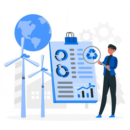
Data is the biggest challenge when it comes to connecting farmers with carbon markets. SourceTrace brings experience of nearly a decade in building solutions to meet the data gap in agriculture to carbon farming.

Our solution, CarbonTrace, helps organisations solve the data challenge in carbon farming. CarbonTrace has the unique distinction of being useful for large farms as well as small farm holdings. By aggregating small farmers, our goal is to include them in the sustainability network and passing the benefits of carbon sequestration down to the smallest contributors.

Bring all stakeholders on one platform

Bring all stakeholders on one platform

Farmers, inspectors, traders, funders and more

Capture verifiable data from the ground at every stage

Combination of ground and satellite data to leave no gaps

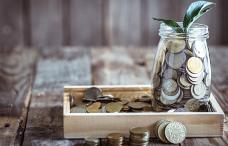
Transparent and auditable program management

Farmer contracts, payments, credit generation - all verifiable

Easy impact assessment to build scalable programs

Helps build scale by meeting concerns and requirements

carbonTrace meets the
data gap

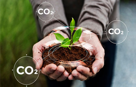
Track every improvement in growth practices at the farm level:

• Fertilizer application and tillage

• Water management

• Residue management

• Cash crop and cover crop planting and harvest

• Grazing and livestock management practices

Who needs CarbonTrace

Agri-food Corporations

Looking to make carbon footprint calculation a part of your sustainability goals? We can help.

Carbon farming technology companies

If you are building a calculator but don’t have ways to verify ground data, you need us.

Sustainability funds and Governments

Need a platform to bring transparency & co-ordination in a multi-stakeholder project? That’s us.

CARBONTRACE – STAKEHOLDER MAP

Why CarbonTrace

Makes agriculture future ready

icon2

Reduces agriculture’s carbon footprint, making it competitive

icon3

Verifiable benefit transfers

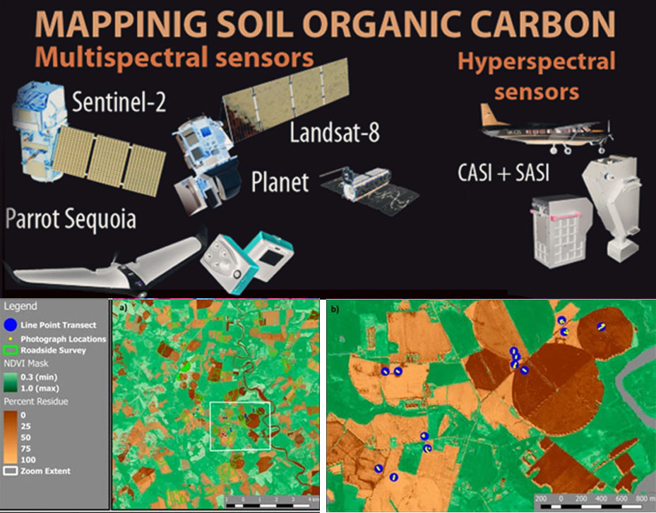
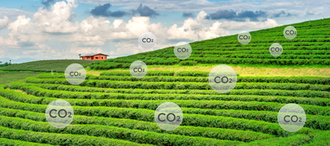
Satellite based Soil Organic Carbon Storage Monitoring

SourceTrace uses data from Sentinel and Landsat satellite imagery to bring ease and accuracy into carbon storage estimations. The automated processing chain was developed to process the multi-sensor satellite imagery and derive meaningful information at farm level.

Our satellite data combined with verified data from the ground enable you to see the entire picture of conservation practice adoption, for example tillage and crop residue burning etc.

SOURCETRACE'S software solutions have been deployed across 37 countries and 4 continents already. We are on a mission to make agriculture and food systems more sustainable. Get in touch and we will extend our expertise and commitment to you.

About SourceTrace

SourceTrace is a SaaS (Software As A Service) company that focuses on sustainable agriculture and empowerment of farmers.

SourceTrace's advanced technology platform DATAGREEN provides comprehensive solutions to manage all aspects of the agricultural value chain.

Media

PC Quest Magazine
This will be the decade of Indian AgriTech

+ READ MORE

Whitepaper

Whitepaper
SourceTrace in 2022

+ Download Now

Case Study

Case Study
Here’s the story of how SourceTrace’s solutions, deployed by Fruitmaster Agro Fresh Pvt.Ltd.

+ READ MORE

© SourceTrace. All rights Reserved
Food and Beverage Technology Review

Today, at SourceTrace we’re happy to share our moment of pride and fulfillment, having made it as the cover story in the Food and Beverage Tech Review.

Read full article

x

Download our new whitepaper
'Traceability in 2020: Global Scenario with a focus on India'